
In October 1884 astronomers and representatives from 25 countries convened in Washington at the International Meridian Conference to recommend a common prime meridian for geographical and nautical charts that would be acceptable to all parties concerned. When the meridian of the Royal Observatory at Greenwich was by nearly-unanimous consent adopted as the prime meridian, it was remarked how convenient this choice was as it insured that the 180° meridian, where formally the date line should be located, mostly passed over water. However, no attempts were made during this conference to specify the exact course of the date line when it happened to cross land or pass through island groups.
As such the term ‘International Date Line’ is thus in fact a misnomer. Its exact course was never defined by any international treaty, law or agreement. At the end of the 19th century, George Davidson (1825-1911), the pioneer scientist and surveyor of the American West Coast, summed up the situation as:
“There is no International Date Line. The theoretical line is 180° from Greenwich, but the line actually used is the result of agreement among the commercial steamships of the principal maritime countries.”
Due to the lack of any international guide lines for the location of the date line, 20th-century map makers have tended to follow the recommendations of the hydrographic departments of the British and the American Navy. Both departments regularly issue charts and pilot books for the Pacific Ocean region that represent the date line as a series of connected straight lines (or better ‘circle segments’). The earliest recommendations issued by these departments referring to the date line appear to date from 1899 and 1900.
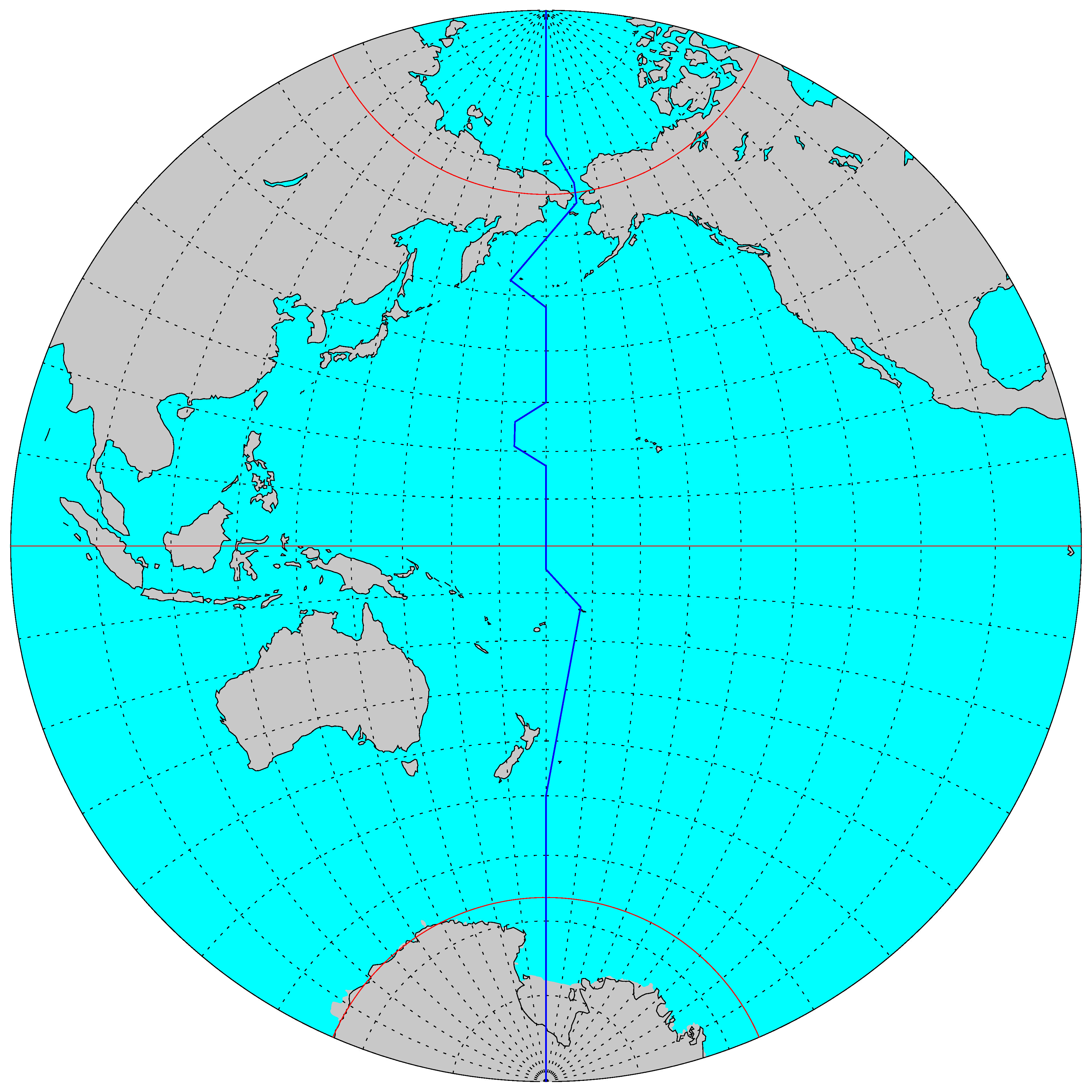
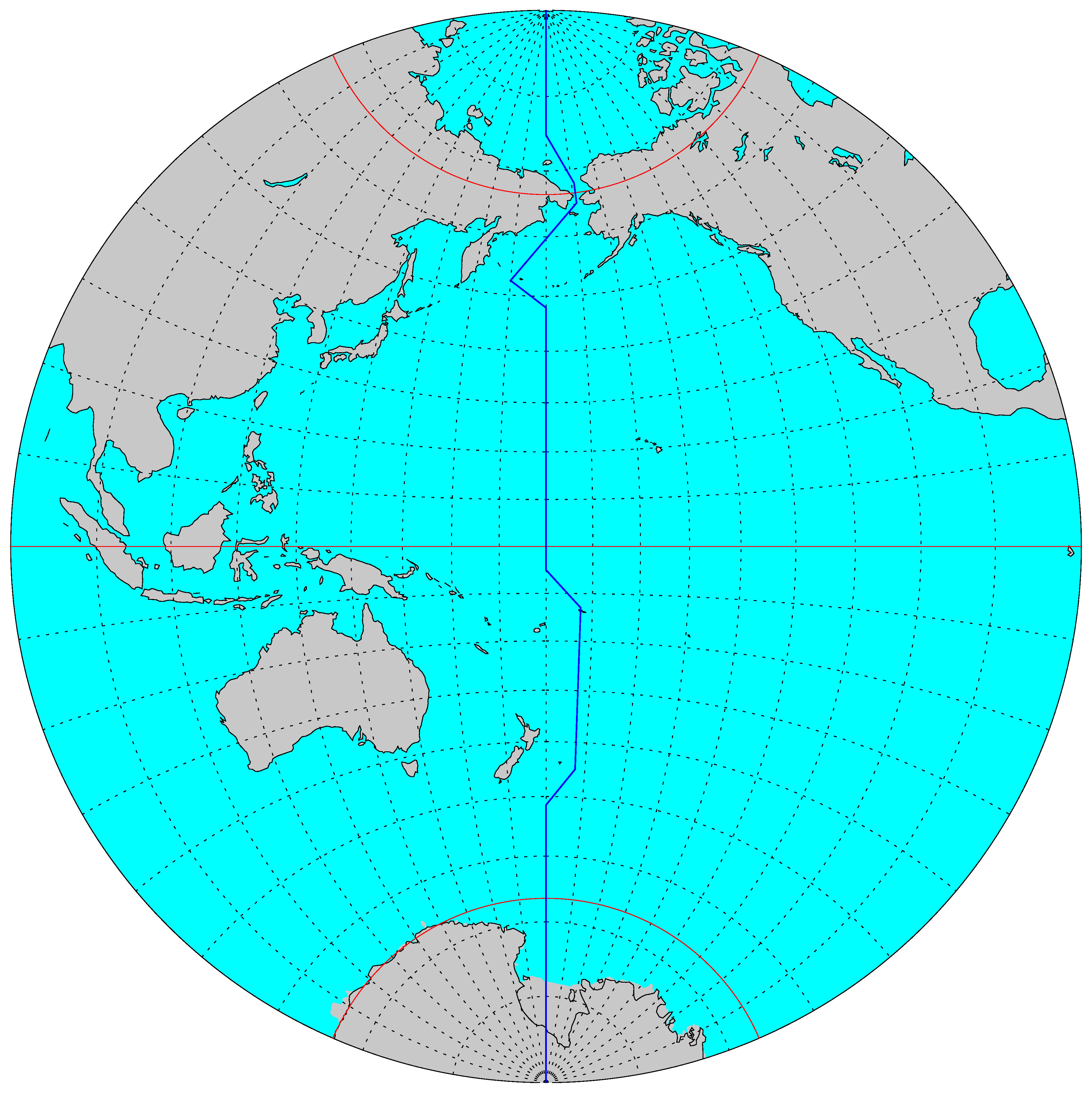
Two adjustments of the date line took place in 1910 near the island chain of Hawaii and between Samoa and the Chatham Islands. In the former case a small westward extension of the date line had been deemed necessary so that the small islands of Patrocinio (also known as Byers’ Island) and Morrell Island (also known as Merrel Island) featured on most 19th-century nautical charts would keep the same date as Hawaii. By 1910 the non-existence of these islands had become firmly established and the date line was straightened out at that point.
North of the Bering Strait, at the latitude of Wrangel Island (Ostrov Vrangelya) which separates the East-Siberian Sea from the Chukchi Sea, the date line experienced some local adjustments during the early 1920s. This uninhabited island, named after the German-Russian explorer Ferdinand Petrovich Wrangel (1797-1870) and straddling the 180° meridian, was always regarded as Russian territory but became the focus of an international incident in 1921 when the Swedish-Canadian polar explorer Vilhjalmur Stefansson (1879-1962), acting on his own authority, claimed it (or only the part east of 180°?) for Canada. A Canadian expedition to colonize the barren island failed miserably and by 1926 the Russians had re-established their claim by settling the island with Russian-Siberian colonists. The temporary adjustment of the date line in 1921 to bisect Wrangel Island would appear to indicate the initial recognition of the Canadian claim on this island by the British Hydrographic Department.
 |
 |
 |
| The location of the International Date Line in 1900 (note the westward excursion of the International Date Line at the latitude of Hawaii to accommodate the supposed locations of Patrocinio Island and Morrell Island) | The location of the International Date Line in 1910 (the International Date Line has been straightened at the latitude of Hawaii and the Chatham Islands have switched to the Asian day count) | The location of the International Date Line in 1921 (note the bisection of Wrangel Island by the International Date Line) |
![]()
![]()