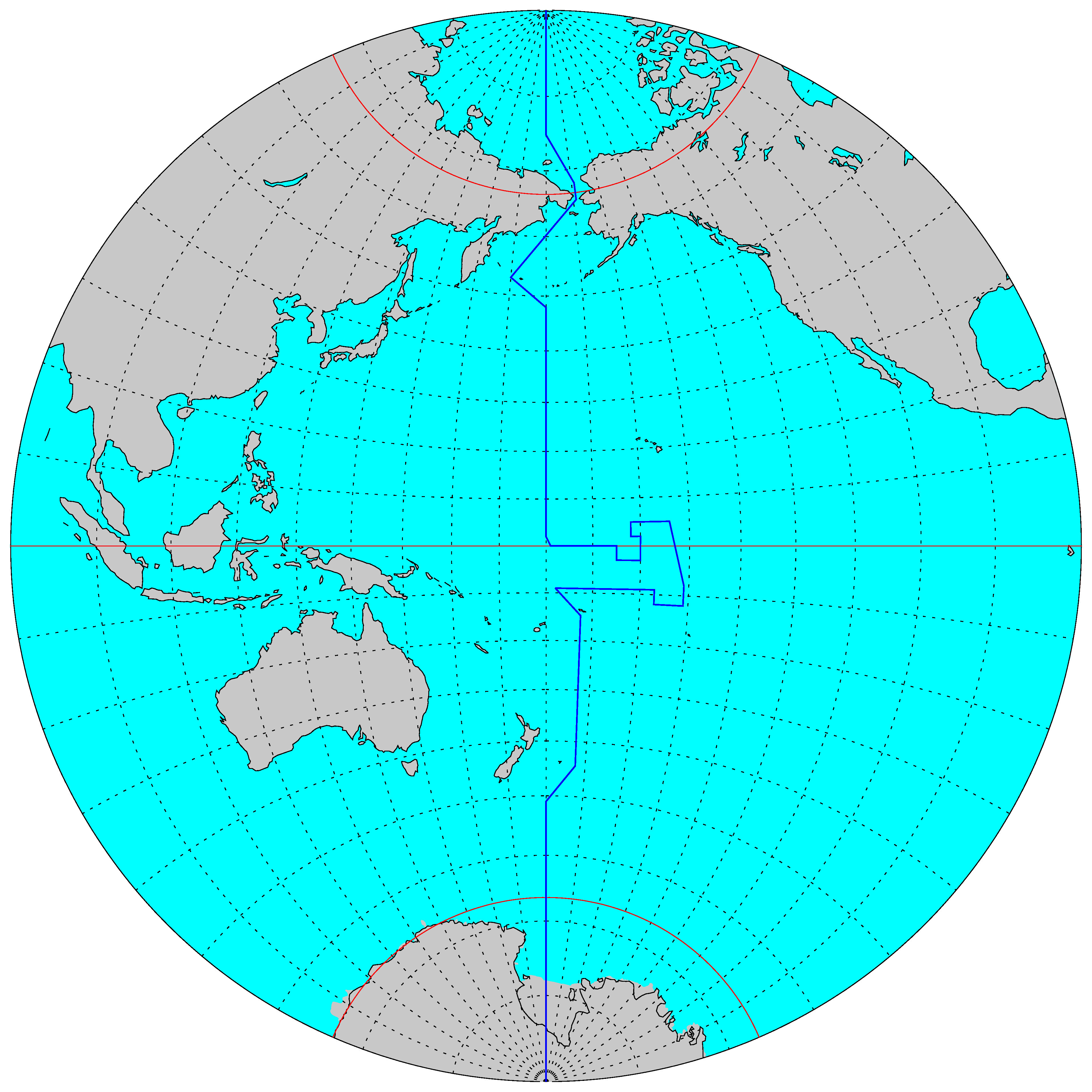
In 1994 the government of Kiribati announced that they would adjust the location of International Date Line. This extended group of islands (comprising the Gilbert, Phoenix and Line Islands) forms an independent republic within the British Commonwealth since 1979. Spread across an ocean area of no less than five million square kilometres, it consists of some 33 small atolls with a total surface area of only 726 square kilometres. About twenty of these atolls are inhabitable, with an estimated total of about 105 thousand inhabitants.
For many years the International Date Line, which for historic reasons bisected the island republic into two halves, had been viewed as an annoying economic nuisance. The western part of the republic was always 24 hours ahead of its eastern part, and there were only four days in each week when official business could be conducted between both parts. To put an end to this situation, Teburoro Tito, the president and foreign minister of Kiribati from 1994 to 2003, announced that on 1 January 1995 the International Date Line would henceforth run along the many-cornered eastern boundary of the republic. For the inhabitants of the eastern part of Kiribati this meant that Friday, 30 December 1994 would be followed by Sunday, 1 January 1995.
It was only realized afterwards that the Kiribati’s most easterly islands would then become serious contenders in the race of which place in the Pacific would first to greet the rays of the rising sun at the begin of the third millennium.
The Kiribati adjustment gave the International Date Line, which during most of the 20th century had remained relatively close to the 180° meridian, a very noticeable eastward protrusion.
The most recent adjustments to the International Date Line were made in the last day of 2011 by Samoa and Tokelau. In order the improve trade and travel connections with New Zealand and Australia it was decided to move the islands to the Asian side of the International Date Line. This was put into effect by announcing that Thursday, 29 December 2011 would be followed by Saturday, 31 December 2011.
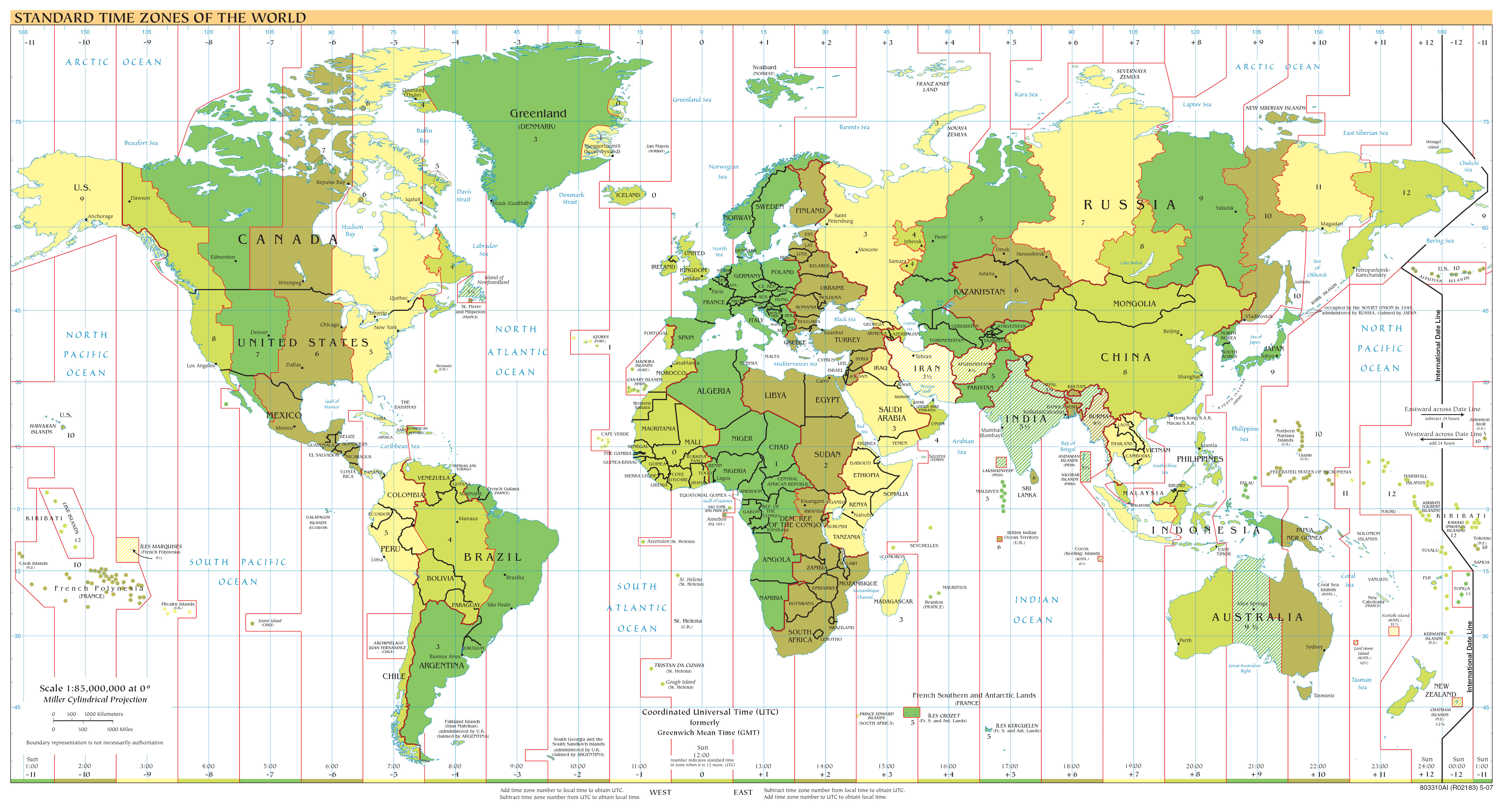
However, since the Kiribati, Samoa and Tokelau adjustments of the International Date Line, many map- and chart makers still publish maps and atlases which depict the former location of the International Date Line. Although the most recent issues of the Standard Time Zones chart compiled by the Nautical Almanac Office (printed in the annual Astronomical Phenomena and available online from the World Time Zone web page of the U.S. Naval Observatory) are aware that Kiribati observes the Asian day count, the International Date Line is locally still drawn as a straight line through the island group.
Many internet sites on time zones and the International Date Line still give incomplete or out-dated information, one of the very few that does give a correct depiction is www.worldtimezone.com.
![]()
![]()