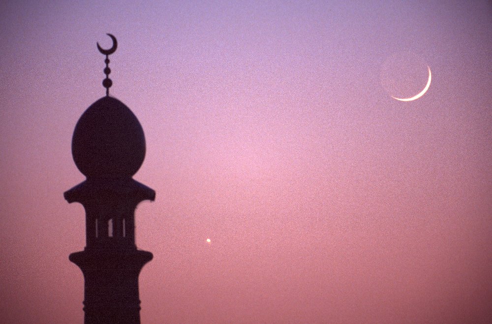
Recent progress in astronomy and in computing techniques now makes it possible to calculate the positions of the sun and the moon at any time with stunning precision but predicting when the thin sliver of the lunar crescent can first be seen in the sky from a given location after its conjunction with the sun still remains a difficult problem.
The main cause for this problem is the fact that the faint and narrow lunar crescent has to be detected shortly after sunset, when the moon is still close to the western horizon in the twilight sky. It is obvious that the weather, the local transparency of the atmosphere and the level of light pollution are important factors for successfully detecting the lunar crescent, as well as the experience of the observer.
Numerous computational methods and algorithms for predicting the visibility of the lunar crescent have been proposed in the past (a comprehensive bibliography can be seen here) but the method now most favoured by astronomers is based on the Yallop algorithm, proposed in 1997 by Bernard D. Yallop of the computing section of HM Nautical Almanac Office.
Yallop’s algorithm computes a lunar visibility test parameter q which is based on the geocentric difference in altitude (i.e. uncorrected for atmospheric refraction and parallax) between the centre of the sun and the centre of the moon at the ‘best time’ for a given observer and the topocentric width of the lunar crescent. From an analysis of nearly 300 observations (successful or not) of the lunar crescent, Yallop determined the following visibility criteria for the lunar crescent:
| A | q > +0.216 | easily visible to the unaided eye | ||
| B | –0.014 < q < +0.216 | visible to the unaided eye under perfect atmospheric conditions | ||
| C | –0.160 < q < –0.014 | optical aid needed before seen with the unaided eye | ||
| D | –0.232 < q < –0.160 | only visible with binoculars or conventional telescopes | ||
| E | –0.293 < q < –0.232 | not visible with conventional telescopes | ||
| F | q < –0.293 | below the Danjon limit (7°) |
Note: with specialized observing instruments using digital image-enhancing techniques several observers have recently successfully detected the lunar crescent in regions E and F. In radio wavelengths near 3 cm (circa 10 GHz) it is even possible to observe the moon when it is only 2° from the sun.
The optimum time for searching the young lunar crescent is about halfway between the local times of sunset and moonset. At sunset the western horizon is still too bright to detect the faint lunar crescent against the sky which is still partially illuminated by the sun. As the sun sinks further below the horizon the sky will get darker which makes it easier to find the lunar crescent. However, one should not wait too long as the moon also moves closer to the horizon and becomes fainter due to the rapid increase in atmospheric extinction.
The ‘best time’ is here defined as the time of sunset increased by 4/9ths of the time interval between sunset and moonset. For instance, if the local times of sunset and moonset are at 18:00 and 19:30, then the ‘best time’ to search for the lunar crescent is around 18:40.
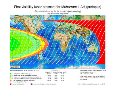
The global lunar crescent visibility maps on this website were generated from Yallop’s algorithm and indicate the local visibility of the lunar crescent at the begin of each lunar month from 2012 to 2024 (Brown lunation numbers 1112 to 1255). For each month three world maps (in Mercator projection) are given indicating the visibility of the lunar crescent on the evening of the day of luni-solar conjunction (or astronomical new moon) and for the two following evenings. Also indicated are the regions where moonset occurs before sunset and where the lunar age (at sunset) is negative (i.e. before luni-solar conjunction or the ‘birth of the moon’)
The red curve on each map connects the points where the crescent moon will be seen in the vertical passing through the sun. Locations north of this curve will see the lunar crescent left (south) of the vertical passing through the sun; locations south of the red curve will see the lunar crescent right (north) of the vertical passing through the sun.
The visibility regions on the maps are clipped at latitudes +63° and –63° as Yallop’s algorithm is not reliable at very high latitudes. For higher latitudes there are also periods in the year when the sun or the moon does not rise or set. Note that the world map, based on the ETOPO1 Global Relief Model, is a topgraphic-bathymetric map and is not coloured according to vegetation but is coloured according to elevation (land) and depth (oceans).
As these world maps may also be useful for Muslims who wish to determine the astronomical begin of the months in the Islamic calendar, the visibility maps are grouped in yearly batches starting with the first month (Muḥarram) and ending with the last month (Dhu ʾl-Ḥijja) of the Islamic lunar calendar.
Note that these world maps are only indicative and assume average observing conditions near sea-level. In rare cases of exceptional atmospheric transparency, such as can be found in dry desert-like regions and at high altitudes, it may be possible to view the lunar crescent outside the nominal visibility zones.
Also note that these maps are based on the Yallop algorithm and may differ from similar maps found on other websites when they use different visibility criteria.
![]()
![]()